
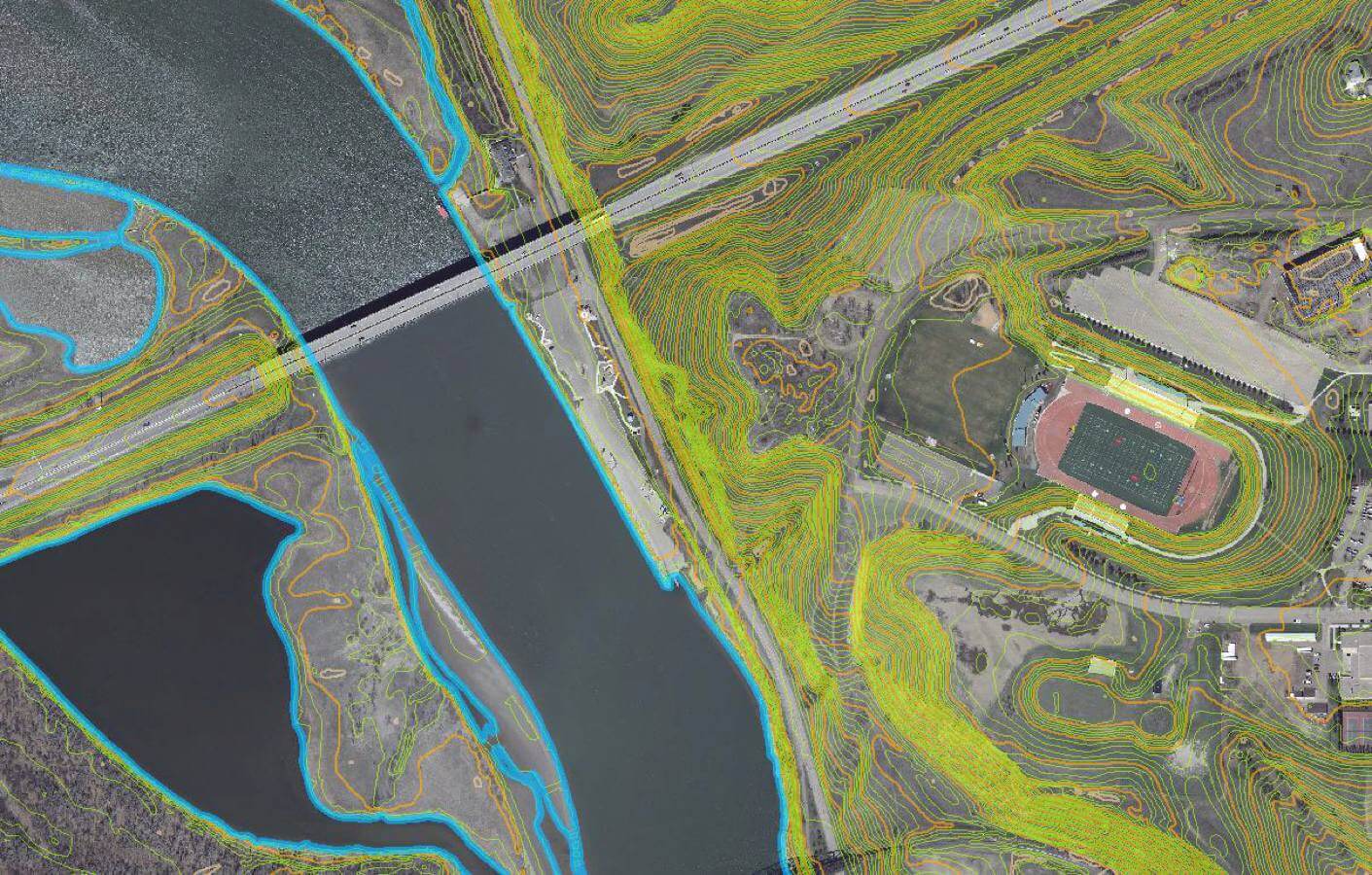
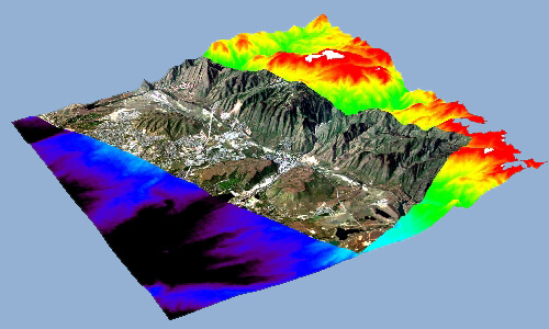
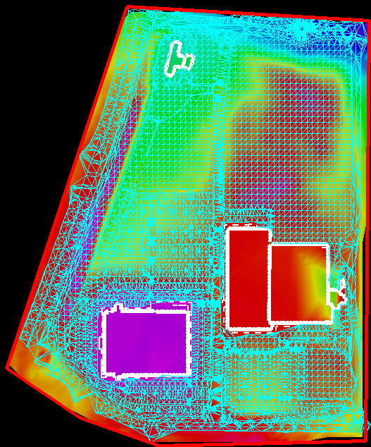
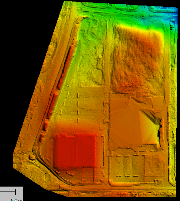
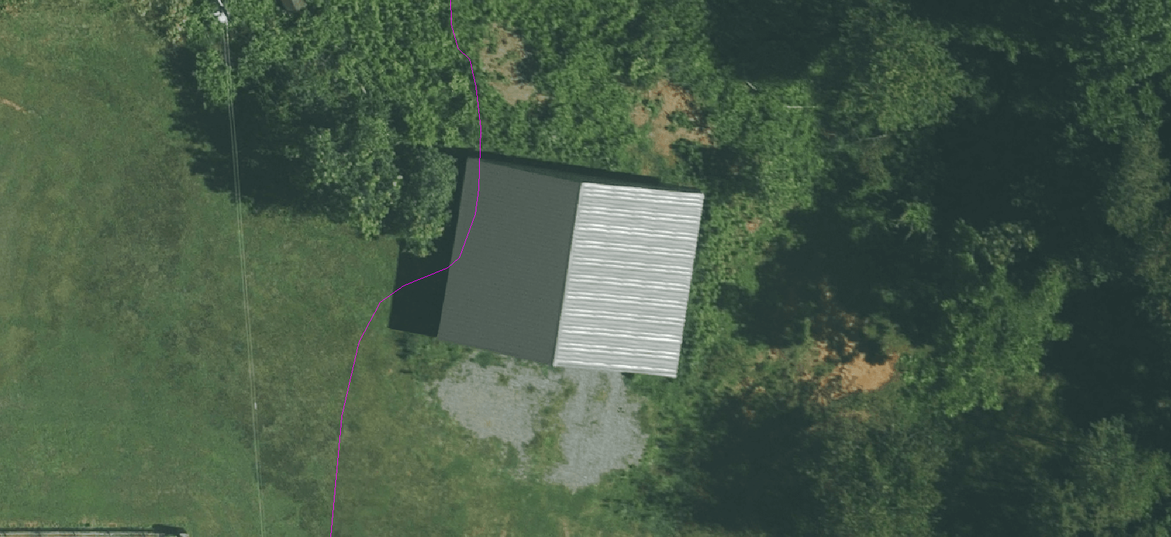
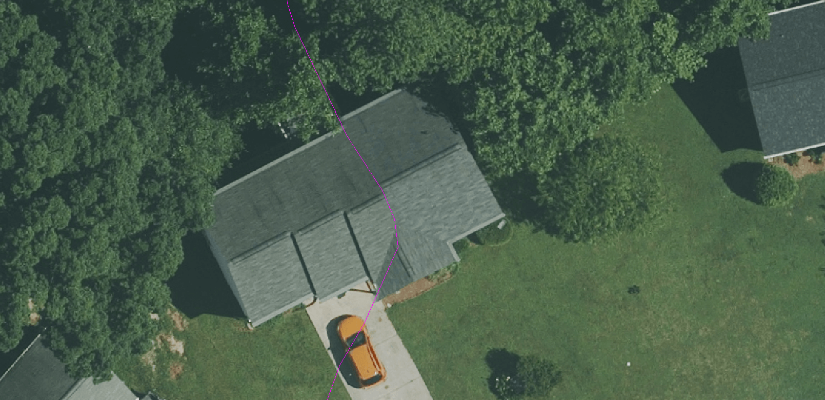
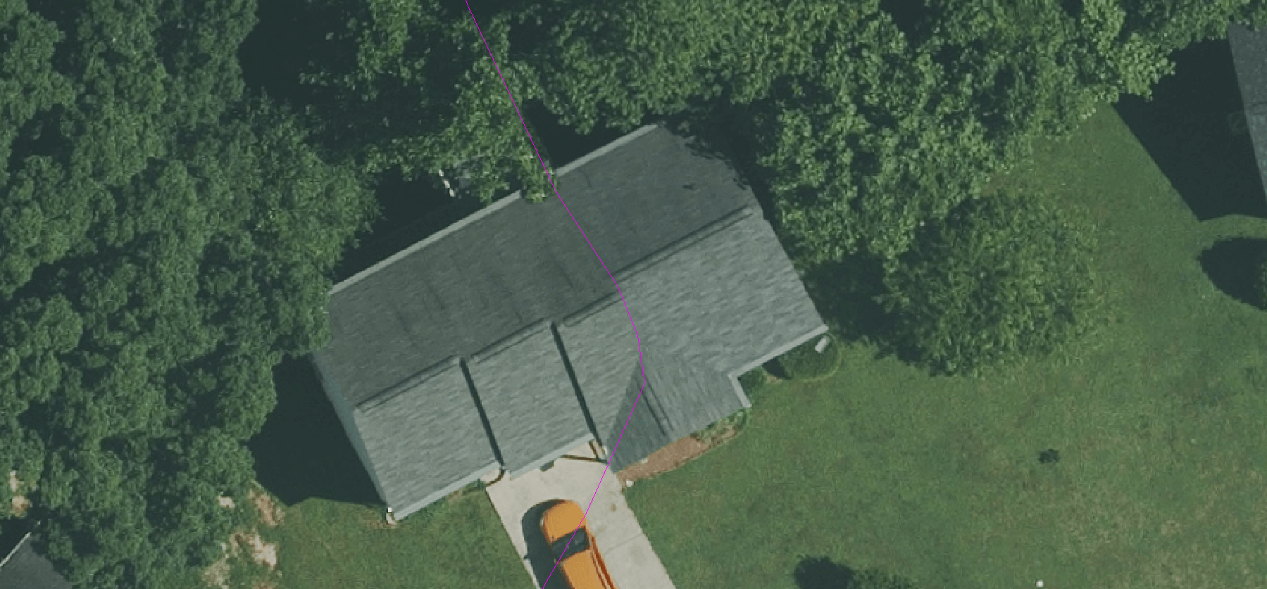
The Light Detection and Ranging mechanism just collect elevation data and along with the data of Inertial Measuring Unit is placed with the aircraft and a GPS unit. With the help of these systems the Light Detection And Ranging sensor collect data points, the location of the data is recorded along with the GPS sensor. Data is required to process the return time for each pulse scattered back to the sensor and calculate the variable distances from the sensor, or changes in land cover surfaces. After the survey, the data are downloaded and processed using specially designed computer software (LIDAR point Cloud Data Processing Software). The final output is accurate, geographically registered longitude (X), latitude (Y), and elevation (Z) for every data point. The LIDAR mapping data are composed of elevation measurements of the surface and are attained through aerial topographic surveys. The file format used to capture and store LIDAR data is a simple text file. By using elevation points data may be used to create detailed topographic maps. With these data points even they also allow the generation of a digital elevation model of the ground surface
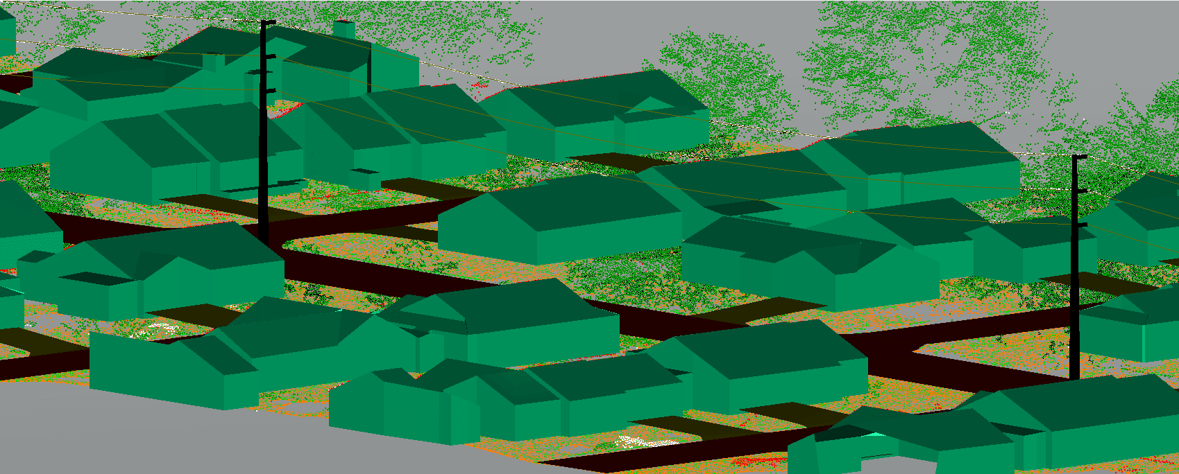
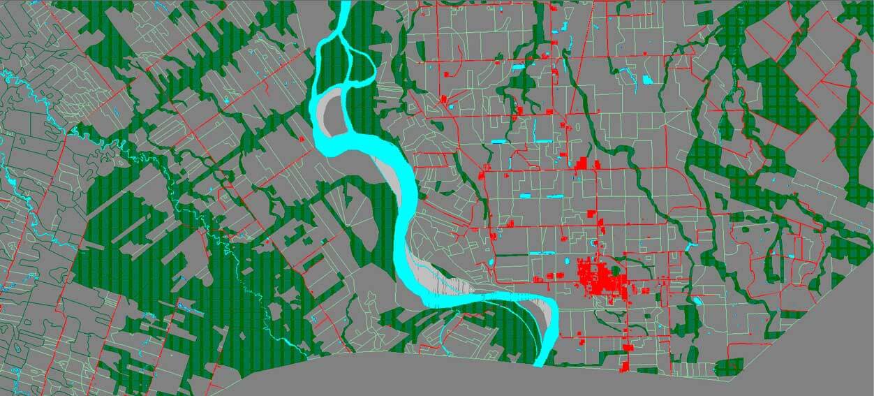
o Ground and Non Ground ClassificationWe classify only ground points for Bar earth Classification and data cleaning noise removal.
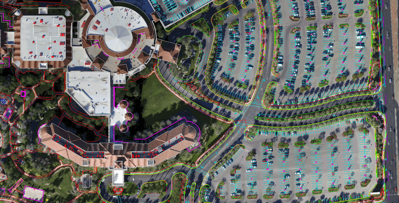
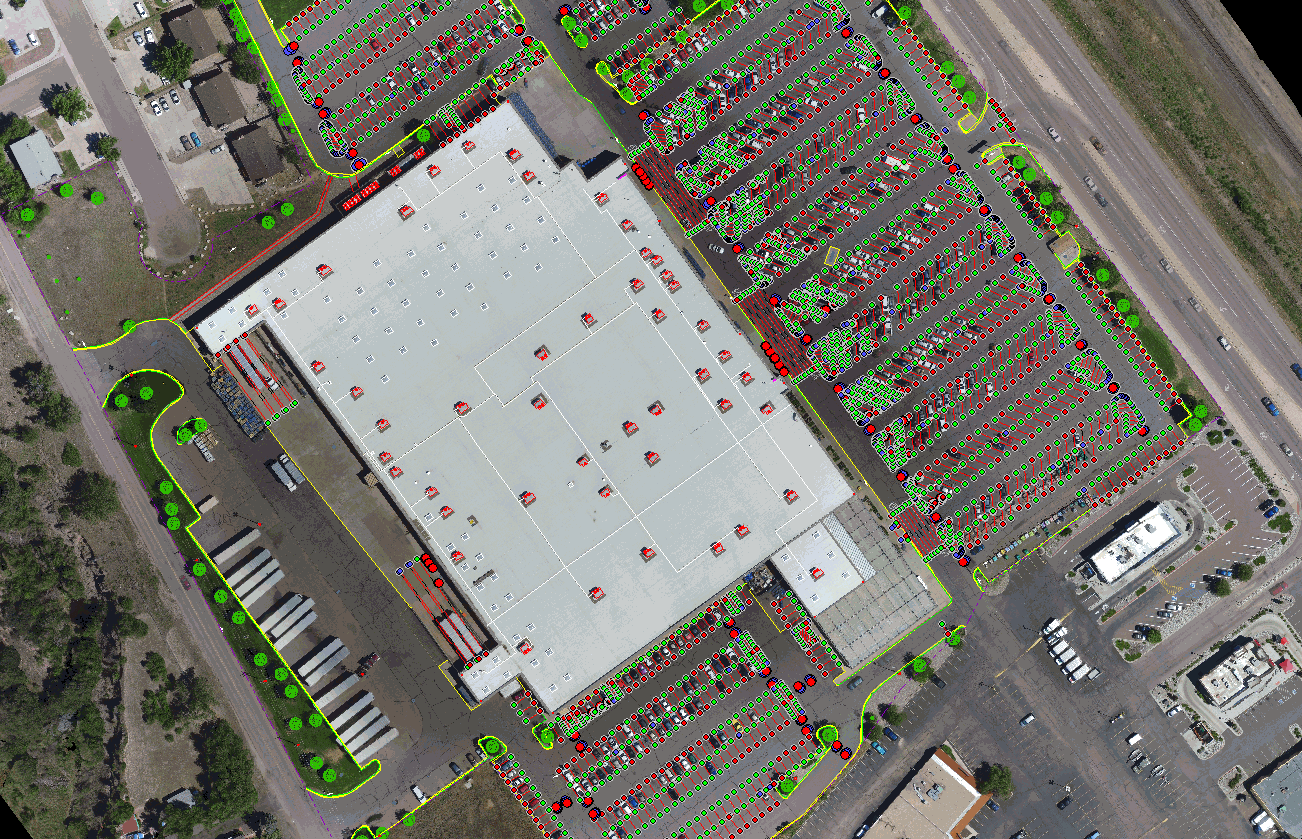
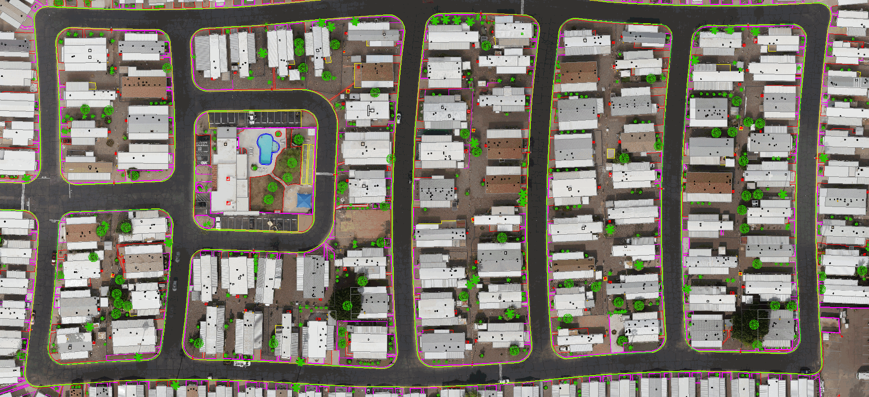
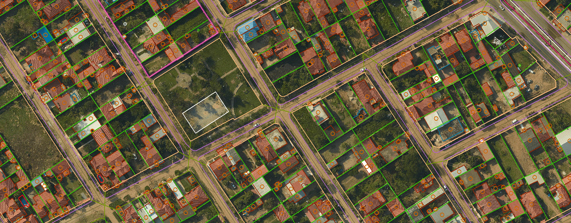
o Advanced classificationWe classifyBuilding, Bridge, Road, Vegetation,Car, and man-made feature etc....
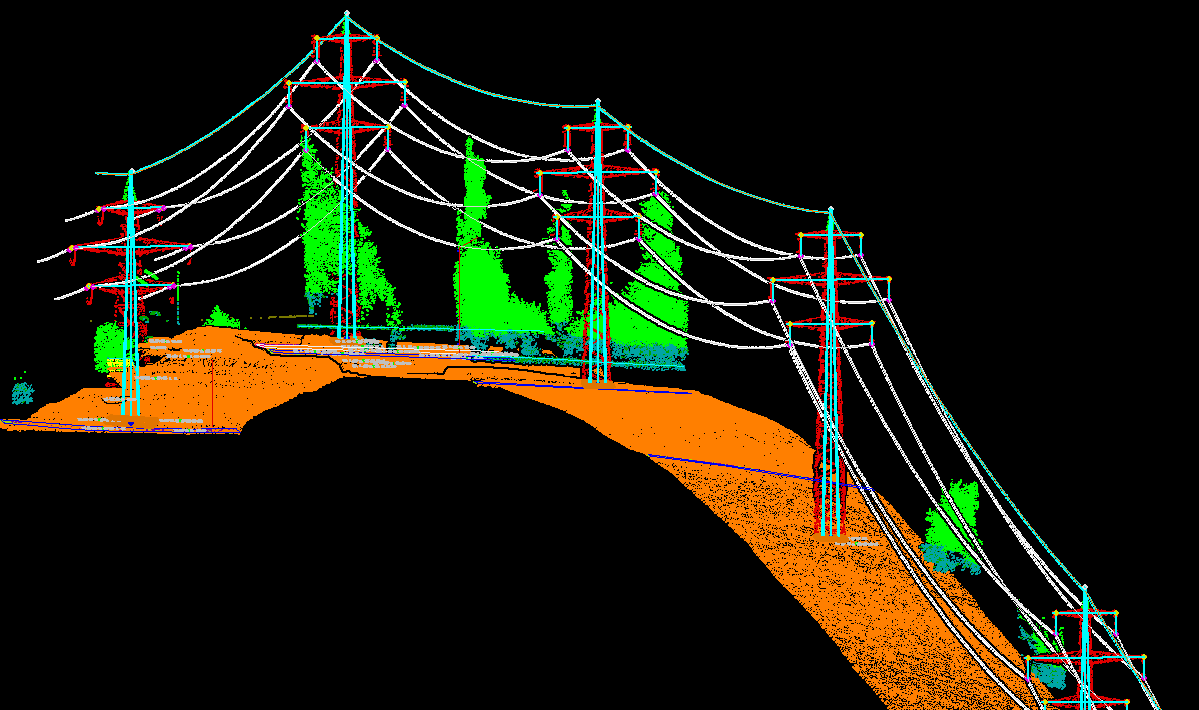
o Power line Classification 2D-3D power line transmission and Distribution network design.
o Ortho generation & Contour generationUsing DEM and photos, we generate ortho photo and contour generation as per specification interval.
o Feature ExtractionAs per requirement we capture features from LAS files to .dwg or dgn.
o 3d Building modelingWe Vectorisation3d buildings from LAS file and complex building will be auto generate and manually edited and fixed.
Mobile Mapping also usually termed as Mobile Lidar, helps capture and process data with high accuracy. The terrestrial scanner is mounted on a vehicle enabling us to scan large areas saving time. Mobile mapping is very commonly used in road mapping and highway facility management. ?Cronquests strong Mobile Mapping team creates digital map data and focuses on feature extraction. These include external asset and built environment from a range of feature classes like utilities, vegetation, infrastructure and transport & traffic signage.
o 2D and 3D vectoring and modeling.
o Topographic & planimetric mapping.
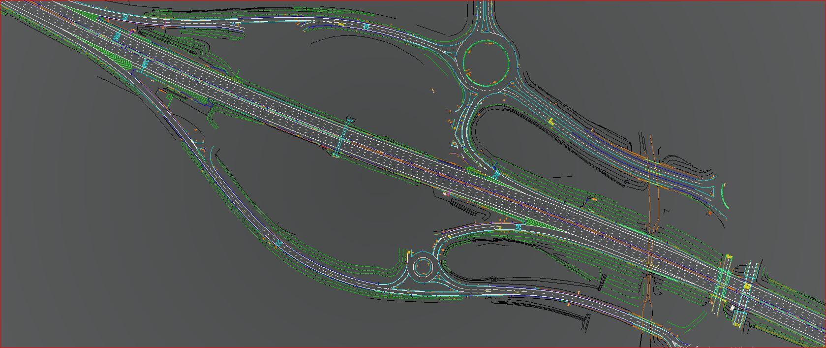
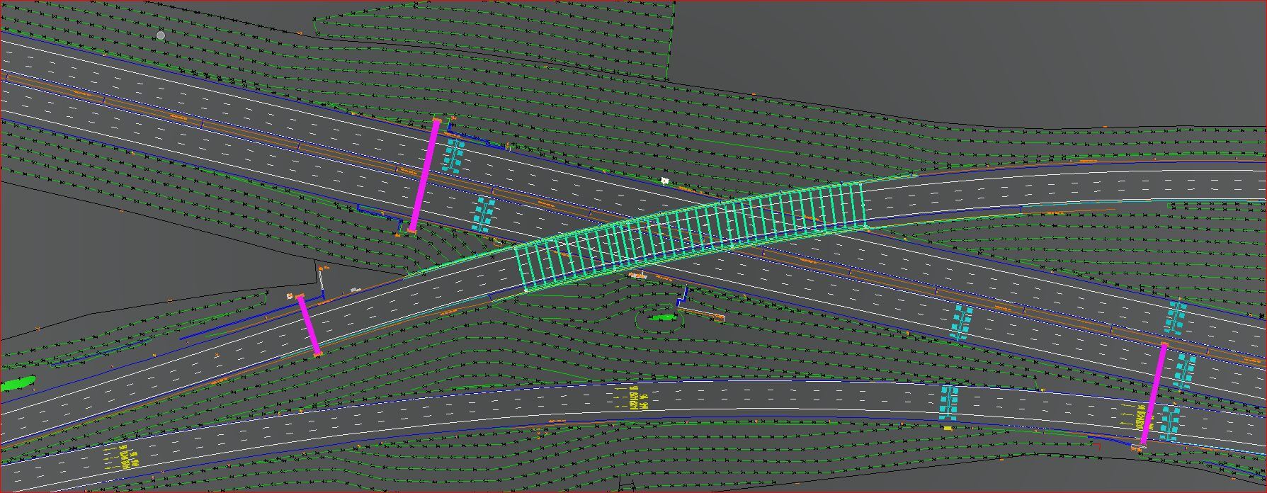
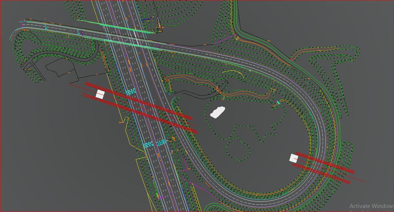
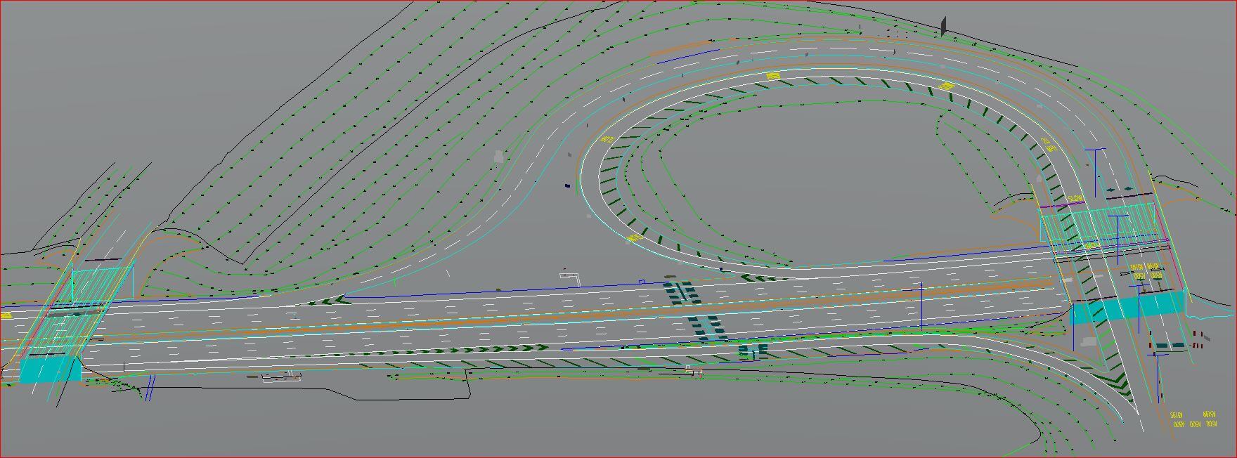
o Road and Highway mapping.
o Rail mapping.
o Bridge mapping.
o Tunnel mapping.
o Asset and Facility mapping.
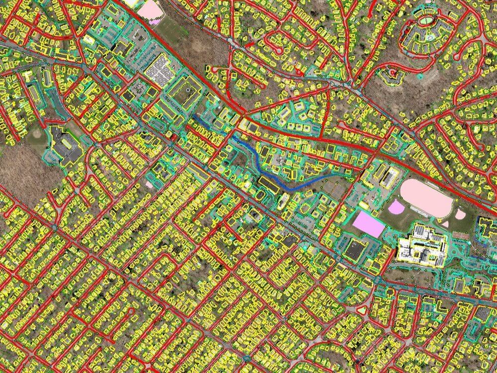
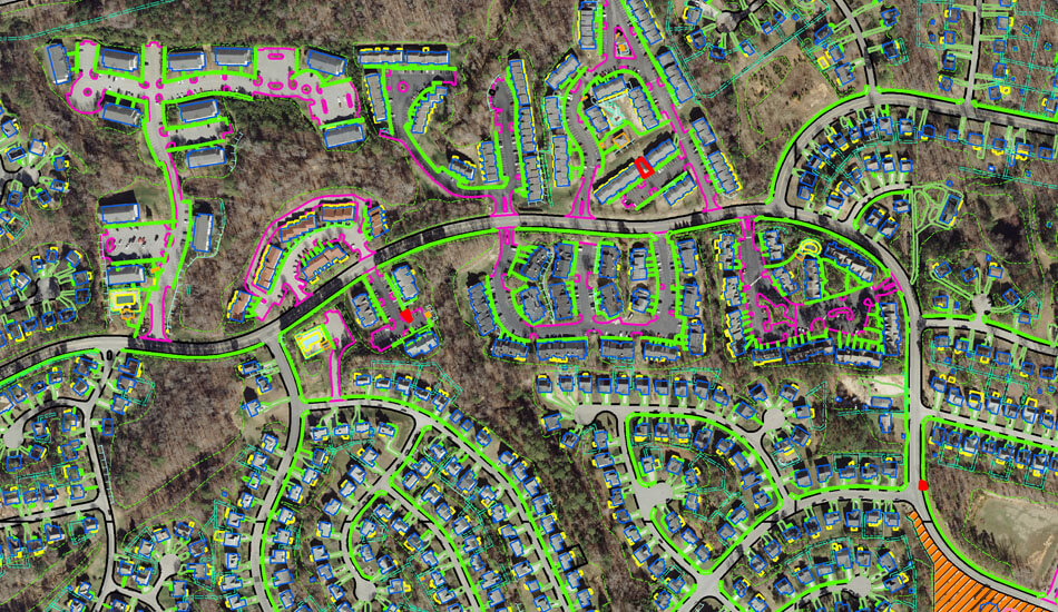
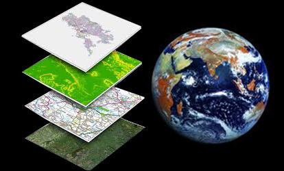
Virtually every GIS project requires significant work to manipulate and organize spatial information, and catalogue data and establish metadata. Solutions offers a variety of data preparation, data analysis, mapping services, and training in support of enterprise GIS projects.
o Data creation - Aerial and Satellite Mapping to generate base maps, thematic maps, DEM (from stereo satellite data) and generate perspectives of systematic change.
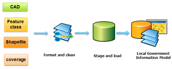
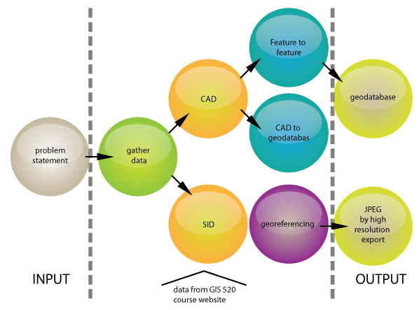
o Data conversion and migration with expertise in handling data in variety of formats (AutoCAD/Microstation/MapInfo/ArcInfo Coverage to Geodatabase).
o Geospatial database management including spatial data modelling, migration and versioning of geo spatial data.
o Defining and standardizing GIS data model.
o Complete range of photogrammetric services including Ortho photo & DTM creation, 2D/3D feature extraction.
o Collection of data including public data and private, proprietary data.
o Transformation and loading of data, including automated geocoding.
o Analysis and presentation of data.
o Conversion of data between formats.
o Merging of multiple data sets.
Photogrammetry as a science is among the earliest techniques of remote sensing. The word photogrammetry is the combination of three distinct Greek words Photo, Gram and metry which translated in English literally means,light,drawing and measurement respectively.
o Aerial Triangulation.
o Texturing.
o DEM / DTM Generation.
o Stereo Compilation.
o Topographic and Planimetric Feature Extraction (2D and 3D).
o Ortho Generation and True Ortho Generation.
o Colour Balancing.
o Mosaicking And Tile Generation.
o Contour Generation.
o 3D Terrain Visualization.
o LIDAR Data Post Processing.
o 3D Texturing.
o Orthophotography Services.
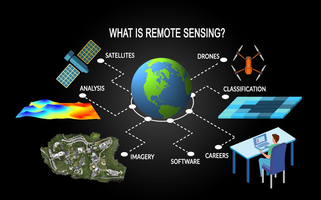
Some projects require acquisition of information on objects and phenomena at a large scale. Physical survey in such a situation is not a viable option. Remote sensing is a technique that is time and cost effective and is therefore apt for such projects.

o Satellite imagery interpretation and classification.
o Classification-supervised and unsupervised.
o Change detection.
o Slope aspect analysis.
o Land cover classification.
o Coastal ecosystem management.
o Forestry mapping.
o Agricultural mapping.
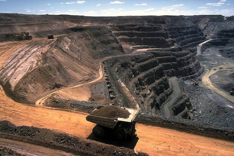
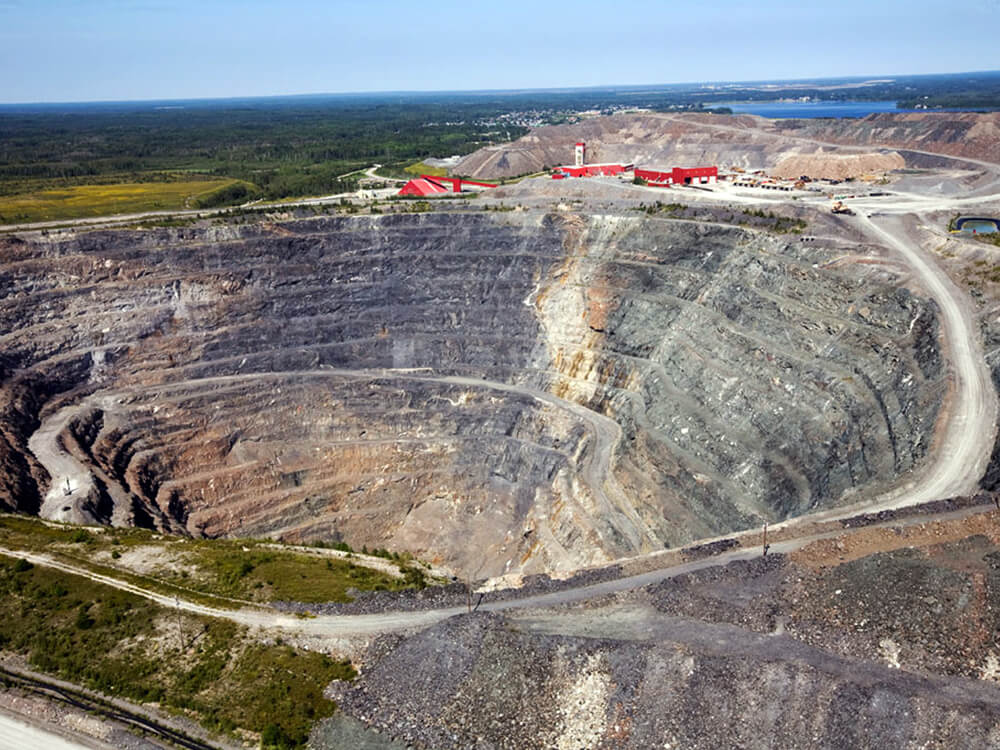
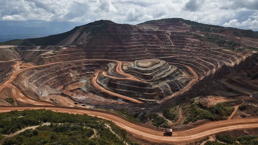
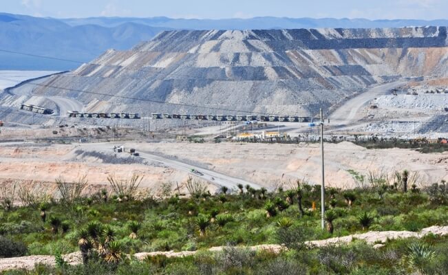
o Mining and geology mapping.
o Environmental impact assessment mapping.
o Clutter data for wireless telecommunication network planning.
o Watershed management.
Unmanned aerial vehicles are becoming more and more available together with drone acquired imagery/data, this contributes a lot to the development of automated photogrammetric processing. Products like Pix4Dmapper, ContextCapture, PhotoScan and many others have formed a distinguished class.
o RGB, NIR and RedEdge image processing.
o creating point clouds that meet the quality of aerial laser scanning.
o creating DSM/DEM surfaces with a high degree of detail in TIN or GRID format.
o building 3D-models using the input imagery for texture generation.
o construction of orthophotos.
o measuring lengths, areas and volumes.
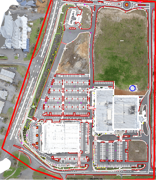
Orthophoto imagery is a valuable layer in a GIS because it provides a generic, inexpensive, and accurate base map. However, in cities with tall buildings it is difficult to create a seamless database of orthophoto imagery. Traditional methods for orthophoto rectification disregard buildings. In this paper, we describe a fully automated process, developed by ASI, that creates true orthophotography, i.e. seamless imagery without building lean. In particular, we present a new mosaicking method, which automatically chooses the best imagery. We also present an automatic method for optimal seaming, which reduces the visibility of the seam line
o Aerial Triangulation (TerraPhotospecific)
o Prepare the DEM from LiDAR or other inputs.
o Add break lines for bridges and wherever required.
o Project triangulated aerial images to DTM.
o Seam editing and color balancing.
o Identify hotspots and see alternate images.
o See for cloud or smoke in images and ensure to take images with least effect.
o Ensure that adjacent images are matched well to each other especially at seam lines.
o Import control points to ensure that images are within acceptable tolerance range.
o Orthomosaic generation.
o Quality control and necessary corrections.
o Tiling and control report generation.
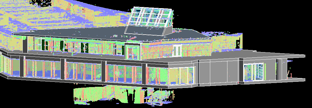
Our scanning facilities and 3D laser scanning technologies will capture 3D measurements from objects as small as a pin head or as large as a nuclear power generation facility. When we remove the constraints imposed by conventional measurement technologies, the scope of applications becomes virtually limitless with 3D, digital data in hand. While much of our work is in reverse engineering and product inspection, there are so many other uses for our 3D laser scanning and 3D measurement data. Our team of highly skilled professionals can transform the raw point cloud or CMM data into output formats that are the foundation for design, documentation, visualization, and analysis as well.
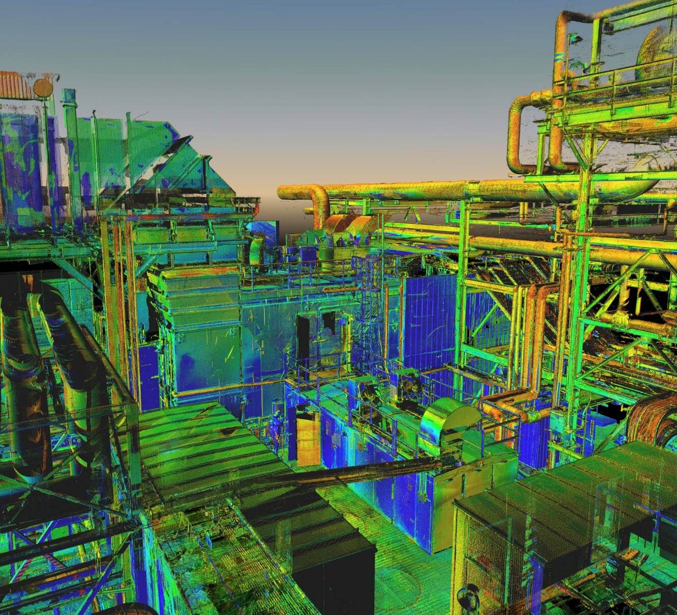
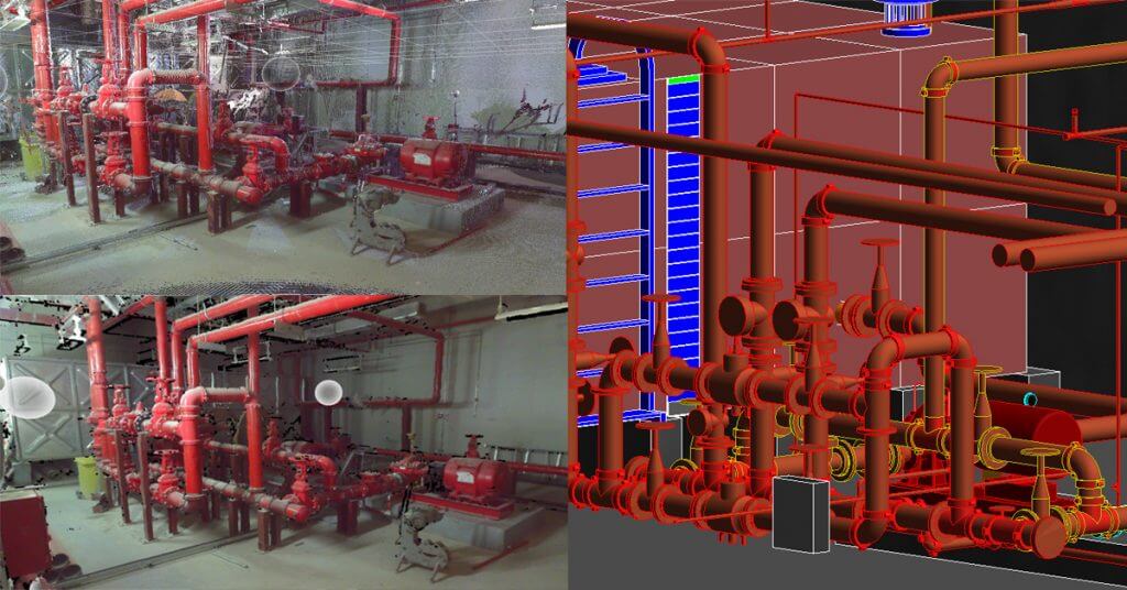
o Get as-built 3D CAD models of your plant.
o Take measurements from a safe distance.
o Get walk-through point clouds.
o Get color panoramic images.
o Learn about design clashes in advance.
o Obtain drawings where none existed before.
o Obtain 1/8? accuracy over large areas.
o Get sections, elevations, floorplans and maps.
o Fully functional solid prototypes for testing.
o Miniatures and souvenir items for promotions or trade shows.
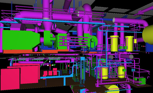
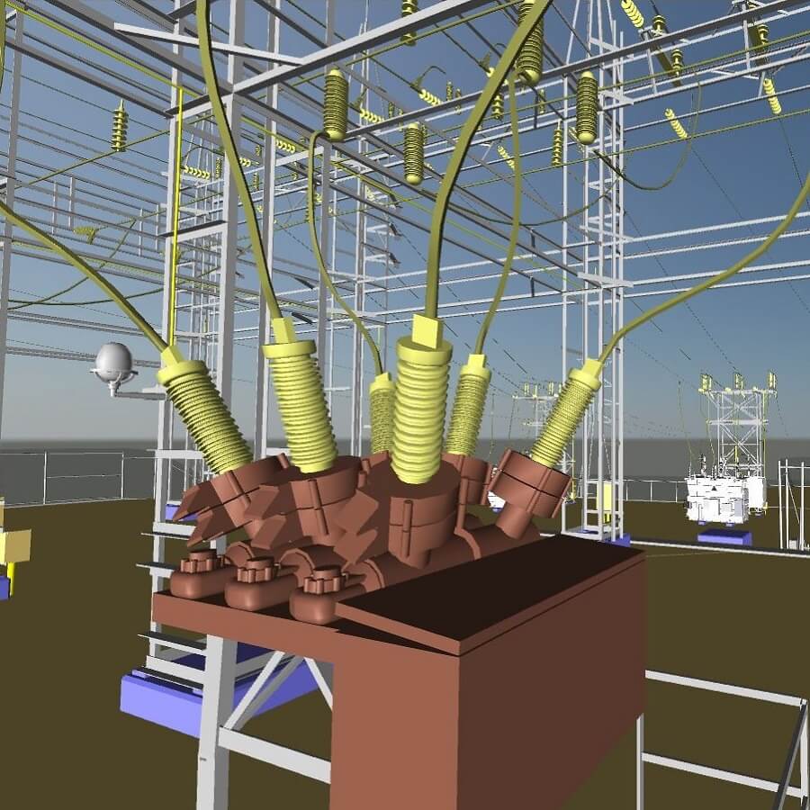
Building Information Modeling (BIM) is an intelligent 3D model-based process that gives architecture, engineering, and construction (AEC) professionals the insight and tools to more efficiently plan, design, construct, and manage buildings and infrastructure.
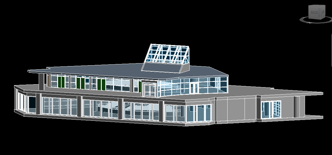
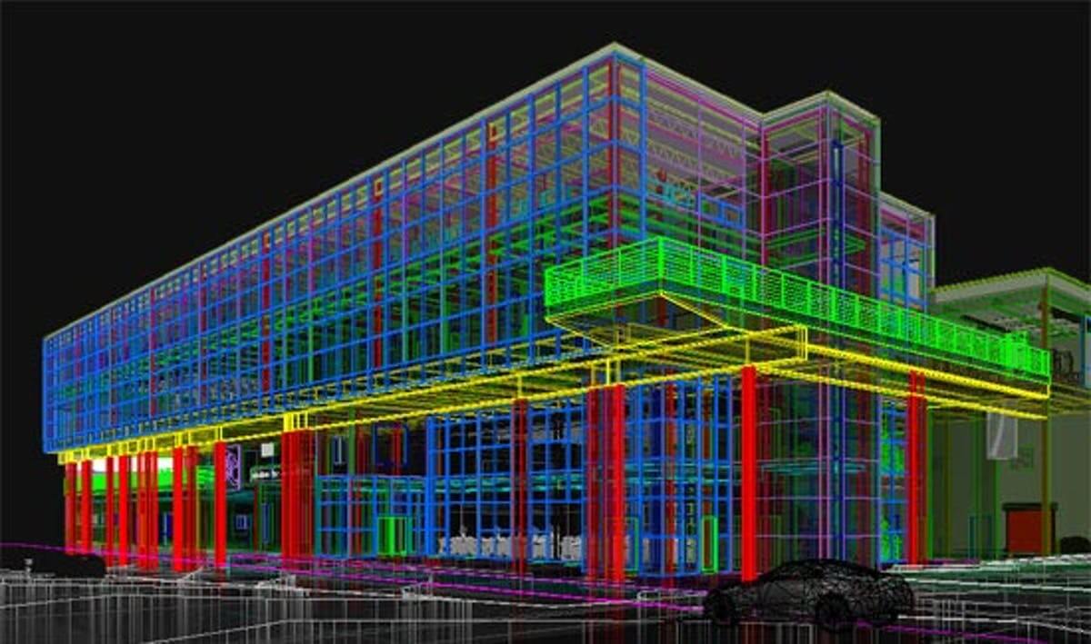
o BIM FOR ARCHITECTURE.
o BIM FOR MEP ENGINEERING
o BIM FOR CIVIL ENGINEERING.
o BIM FOR PLANT.
o BIM FOR CONSTRUCTION.
o BIM FOR STRUCTURAL ENGINEERING.
There are many ways to convert GIS data and the conversion may use special conversion programs. Simply, it may involve complex data exporting or importing procedures. As we know there are many data file formats used in GIS, this time we will be converting them from one format to another.
At Land Surveys, our experienced mine surveyors and survey technicians use leading technology and a suite of complementary skills to deliver successful mine surveying solutions, above and below ground. We have what it takes to ensure you always have the mine services you need to move your operations forward.
o Digital Mine Enablement.
o Mine to Port.
o Haulers & Service Vehicles.
o All Business & Mining Applications.
o Wi-Fi Integration.
o LMR & PTT Integration.
o BYOD